You may well go to lots of trouble to get everything else in order, only to find that your planning application is sent back because there’s something wrong with your maps or plans. The result? Your whole schedule may suffer.
Download your planning maps here
So, why might your maps be rejected?
Here are six reasons:
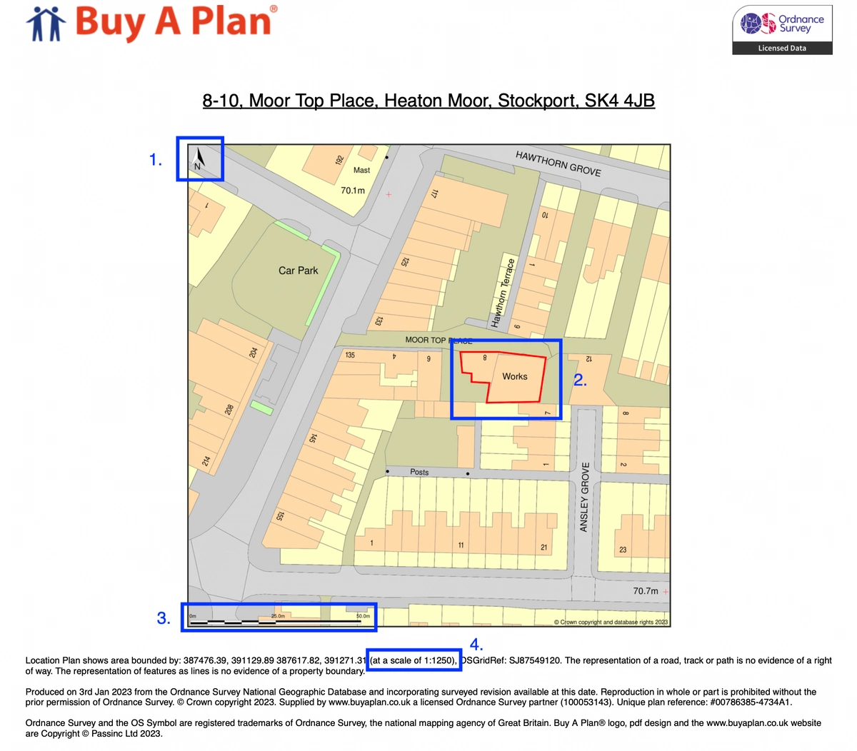
Reason 1: The location of your site isn’t marked clearly on the map. Remember that the planning officer needs to be quite sure where your site is and where its boundaries lie. If the site isn’t shown clearly on the map, the officer can’t process your application. It’s much easier to mark the site accurately on a proper Ordnance Survey map. You can see how it is properly marked (see point 1 on the example plan with red lines marking the property boundary and blue lines marking other land owned but separate from the property.
Reason 2: The map is out of date. The planning officer needs to know that all the surrounding development is shown accurately. However, if you use an old map, the chances are that new development has occurred since it was published, making it more difficult to assess the impact of what you propose. And it’s not just the planning officer who’ll be unhappy; a neighbour whose house has been left off your map may not be too pleased, either.
Reason 3: The map scale is either missing or wrong. It’s important that the scale is clearly shown because the map will be used to assess such things as distance to neighbouring properties or roads. Our Ordnance Survey map extracts have a scale (see note 3 on the example plan).
Reason 4: The map is hand-drawn or perhaps traced from some other map. This is never a good idea as it will probably be inaccurate and may look scruffy, too. The answer is to use Ordnance Survey planning application maps.
Reason 5: The map has been photocopied from someone else’s application. This is a breach of copyright, and the planning authority won’t knowingly condone that. You need to submit planning application maps that are authorised copies.
Reason 6: The map does not point North. All our maps point North (see note 2 on the example plan).
Make sure you follow the official planning regulations which you can find here, in order to submit a correct planning application.
Clearly, the answer is to use the up-to-date, accurate maps that we offer. They're mapped by from Ordnance Survey and they really are the best you can buy, fortunately, you can download these planning application maps from our site.
